
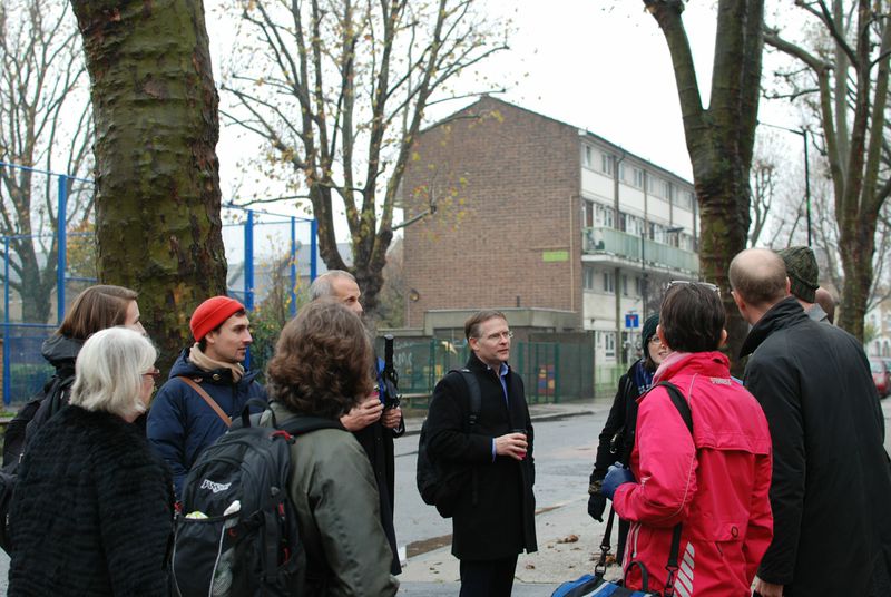
On the 26th of November, a small group of housing stakeholders and LSE London researchers visited the Ailsa Street site in Tower Hamlets to learn more about how one borough is overcoming barriers to increasing housing supply.
The site visit offered a chance to continue the discussion started at our 29th October workshop. David Williams, Deputy Service Head of Planning & Building Control at Tower Hamlets, and a team from the council’s planning department and Leaside Regeneration prepared an informative presentation and tour that illuminated the history of the site, the inherent complexities of developing the area and innovative ideas that are being suggested by the council to stimulate new development.
This site visit provided a chance to discuss specific barriers to bringing forward land for development as well as innovative strategies for overcoming them:

Complicated land ownership pattern
Sections of the Ailsa Street site are owned by 13 different landowners. Coordinating interests and visions for development of the area is therefore immensely difficult. Participants at our 29th October workshop agreed that complicated land ownership patterns present a significant barrier to development on sites across London. The use of Compulsory Purchase Orders (CPOs) may help local authorities facilitate development in areas of complex land ownership, but councils try not to use them if possible, preferring to employ other strategies, such as master planning, to try to encourage multiple land owners to work together. Exploring strategies for overcoming the challenges of complex land ownership should therefore be a focus of further research, and sites across London where development has moved forward despite this barrier (such as at Millbrook Park in Barnet) should be studied to illuminate ways for moving past this issue.
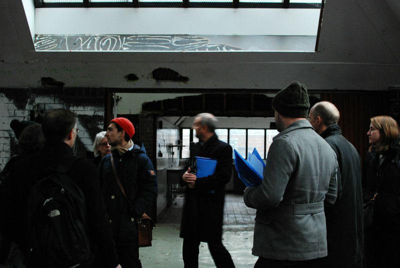
Remediation of land
The Ailsa Street site requires a great deal of remediation before construction of new housing or facilities can begin. These processes are expensive, and the complex pattern of land ownership in the area further complicates the coordination needed to remediate the entire site. The borough has applied for Housing Zone funding in order to finance this work, and grant systems like this may represent a crucial resource for cleaning up sites with high potential yet high remediation costs.
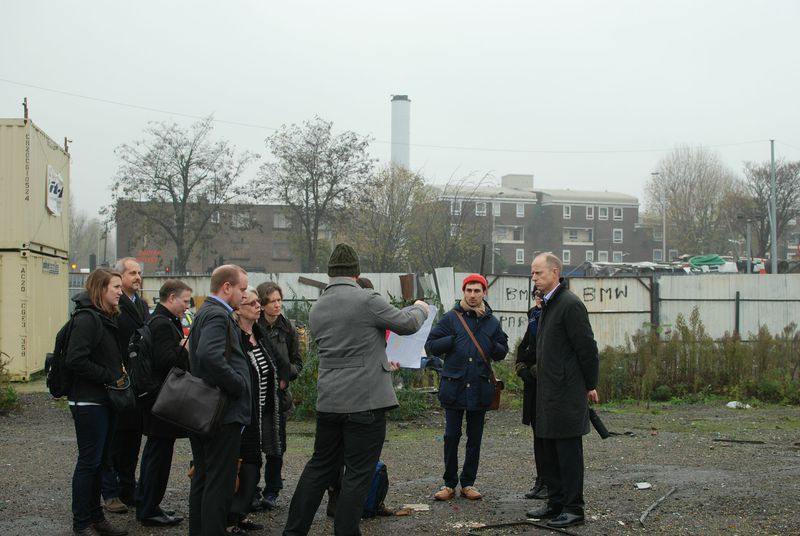
Accessibility
The area benefits from key geographical assets: it includes substantial riverfront (on the Newham side of the river, this frontage has already been developed into appealing public realm) and it is relatively close to employment hubs such as the City and Canary Wharf. A variety of local schools would be accessible to future residents, and the site itself includes a Grade II listed former pupil referral unit building, which the council intends to up-grade into a primary school. Whilst distinctive heritage architecture can be an asset to development, adding character and value (Holman and Ahlfeldt, 2012), it can also further complicate the manner in which sites can be brought forward as listed buildings must be sensitively treated and adapted for modern purposes.
Despite these assets, one of Ailsa Street’s biggest challenges is accessibility as it is bordered to the west by the busy four-lane A12 and to the east by the river which, at present, cannot be crossed on foot or by car. Currently, the PTAL score for the area is only 2, which TfL categorises as ‘poor’. Consequently, to make the site viable for large-scale residential development would require substantial investment in transport and accessibility improvements.
The potential of master planning
Because residential development in the borough is occurring so rapidly, the council feels strongly that master planning can help bring investment even to long-neglected areas like Ailsa Street. Additionally, since the rapid development of other areas has arguably limited the opportunities for quality ‘place making’, master planning can ensure that important considerations such as green spaces, accessibility and density are carefully considered at the outset. Interestingly, the Ailsa Street area has been subject to numerous plans over recent decades but none of the previous strategies have effectively been able to ‘crack’ the site as they, arguably, did not effectively address the multiple challenges present here: ground contamination, access issues, listed buildings and the presence of multiple land owners. The hope of the council is that this latest master planning strategy combined with innovative funding mechanisms including the Housing Zones bid will unlock the site’s potential and, by addressing major barriers like accessibility and remediation head-on, bring development forward.
Master planning in a complex site like this which has had a diversity of former and current uses requires a reimagination of the existing geography. The various barriers present at the Ailsa Street site can make it difficult to envision how future development might look or function, and master planning therefore offers a chance to produce and promote a common vision for the area. Additionally, the master planning approach in the eyes of the council goes beyond “blueprinting” change and includes the potential of it to facilitate partnership working, pulling together stakeholders, the local authority and developers to affect change. The plans for developing the Ailsa Street signs can also tap into the development momentum around Stratford and the former Olympic Site, areas where innovative master planning have guided large-scale redevelopment.
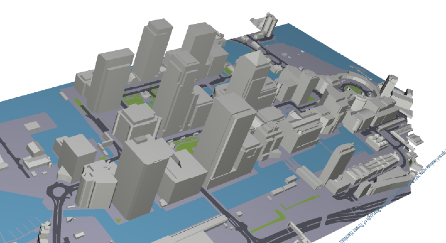
Visualisation mechanisms
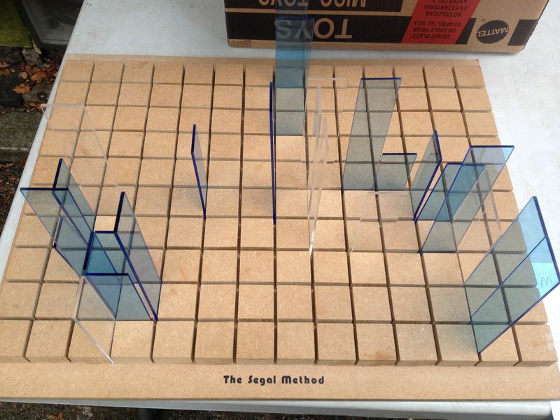
The Tower Hamlets planning team has developed an excellent tool, using GIS technology, to help stakeholders visualise both the impact and reality of new development as well as challenges such as access, light, noise and space constraints. Such new technologies can help both to improve decisions and to allow stakeholders to communicate more effectively with one another to build consent, as the difficulty of communicating spatial ideas during lengthy, complex negotiation processes can be an important issue in accelerating development. We know from older more basic hands-on technologies of visualisation like the Walter Segal self-build tool (see image 5) that even the most rudimentary abstraction techniques can be very useful in creating greater understanding what developing homes on a particular site may look like and imply.
For more information on this site visit or if you have a site that you think illustrates the complexities and opportunities for accelerating residential development in London, please contact Dr. Nancy Holman at N.E.Holman@lse.ac.uk.