by Saad Alsharrah
One of the first synergies between medical investigations and geography was in 1854 when the cholera outbreak devastated London’s Soho borough. Following fruitless theories of attribution from the medical community, which supposed that cholera was caused by particles in the air arising from decomposing matter or other dirty organic sources, the physician John Snow argued that an as-yet unidentified ‘germ’ cell must have been the disease’s primary cause. Snow’s publication theorised that cholera was being spread by an agent in contaminated water, a proposition with which the medical community later agreed. Following his proto-germ theory, he developed a radical method which helped reveal the source of the cholera outbreak. Snow’s pioneering method was the production of a map. His map became the spatial lens that visualised clusters of cholera deaths around the source of the outbreak: a water pump. The cartographic visualisation enabled him to identify the most probable source and intervene by removing the pump handle from the now-famous ‘Broad street pump,’ dramatically reducing the incidence of cholera cases. Dr Snow’s methods were integrated into public health and 170 years later, with the advancement of technology, Geographic Information Systems (GIS) has emerged as an ‘all-pervasive enabling’ technology that is pivotal for spatial analysis, mapping of ecological framings of chronic disease and identifying locational-specific tailored interventions.
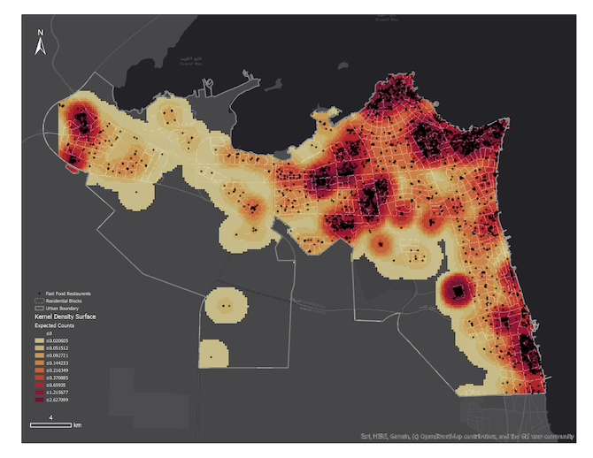
GIS is a computer-based tool that analyses, stores, manipulates and visualises geographic information, to understand and contribute to the resolution of important real-world problems. GIS can answer questions such as ‘where do people live?’, ‘where is the disease clustered?’ and ‘are there any associations with the built, natural environmental and demographic factors?’. In the west, geo-enabling big data for health applications is well established by health departments and research organisations with capacity in applying spatial epidemiology to guide health policy. GIS is applied to understand where and when to mount public health interventions, quantify access to health services, the design quality of care initiatives and health service delivery improvements. For example, the international literature reports consistent significant associations between obesity and Type 2 Diabetes Mellitus (T2DM) and the built environment. However, most of this research is in North America, Europe, New Zealand and Australia, with minimal academic research attention focused on the built environment and associations between diet and physical activity in the Gulf Cooperation Council (GCC) countries.
The GCC countries are ranked the highest in the prevalence of T2DM in the world, with an average of 25.45 percent, raising a major public health concern. In 2015, the International Diabetes Federation estimated that nearly 400,000 adults in Kuwait had T2DM. Caring for patients with T2DM and its associated complications is a crushing burden on Kuwait’s healthcare system. The condition’s preponderance in Kuwait is alarming, and decision-makers are reiterating this concern, yet future visions of health reform and collaborative efforts to scope health care policy developments lack knowledge on the spatial drivers of chronic disease, which are contributing to diabetes prevention and control. Globally, the most effective interventions are those that target behaviour and lifestyle together with changes to the environment. This is because environmental risk conditions shape individual risk factors, and thus the spread of disease.
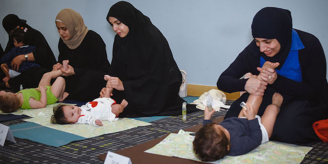
The Dasman Diabetes Institute (DDI), in partnership with the University of Canberra, is driving a geohealth agenda to deal with T2DM in Kuwait and provide innovative solutions that focus on intervention and prevention. The partnership is building and implementing a comprehensive technical infrastructure that integrates health and administrative data with social, built and physical environmental data in support of spatial epidemiological research to understand and prevent T2DM. The spatialisation of this agenda will enable the identification of built, social, natural, and physical environmental factors to be targeted by policy and practice-level innovations to reduce risk factors and prevent disease and the social and economic costs related to obesity, metabolic syndrome and T2DM, and their complications.
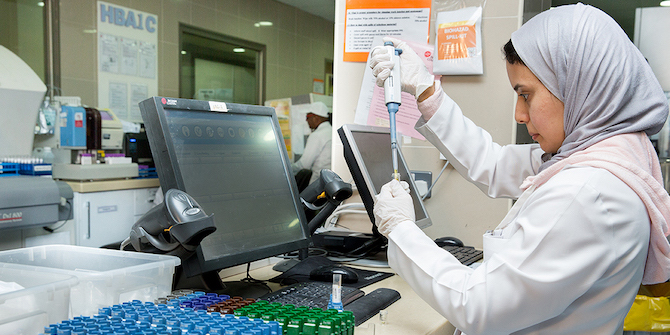
This partnership is developing the first focused GeoHealth Research Hub in the region, DDI’s GeoHealth Lab, with the capacity to apply spatial epidemiology to develop knowledge and understandings of the spatial drivers of T2DM in Kuwait. The lab is developing new methodologies to sustain effective public health and medical care interventions in Kuwait. To exploit its potential in Kuwait, the GeoHealth Lab is facilitating geospatial analysis of the ministry of health data for T2DM prevention. The partnership with the Ministry of Health is integrating the potential of assimilating the ministry’s health outcomes data with the GeoHealth Lab to facilitate a comprehensive understanding of spatial factors related to existing diabetes cases and population risk factors where intervention is possible before the development of clinical disease.
The spatialisation of health research in Kuwait provides a capability to assist the mission of Kuwait’s Ministry of Health to guide the development of health policy. Geo-enabling, the health sector in Kuwait, is supporting and facilitating the coordination of expertise in trans-disciplinary geospatial analysis, health policy, health planning, environmental health analysis and spatial epidemiology.