By Alexandra Gomes, Asseel Al-Ragam & Sharifa Alshalfan
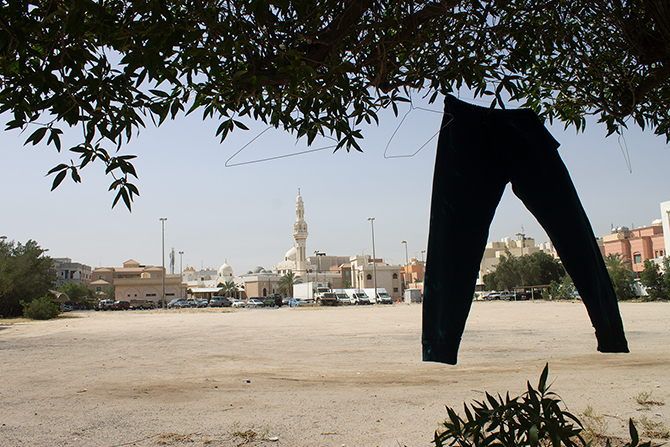
The potential for public space improvement lies in Kuwait’s empty plots. Source: Alexandra Gomes
Kuwait’s population is expanding rapidly and accommodating this growth through sustainable urban development will be a challenge for the small emirate. This calls for a shift in current urbanisation patterns that are contributing to higher levels of motorisation and to inadequate public space that is destructive to individual health and the environment. These unsustainable patterns are common across GCC cities. Consequently, re-evaluating urban growth standards has become increasingly urgent. Our Public Space in Kuwait research took up this focus and explored design and urban planning factors that impact everyday public space use. Local streets in two residential neighbourhoods in Kuwait that differ in demographic composition, density and land use patterns were explored: 4th Street in Qortuba and AlDimna Street in Salmiya. The analysis was based on surveys and observation of the design and use of these streets in relation to urban policies. Our goal is to present policy recommendations that address current challenges in planning, design and user behaviour. We highlight here three of the main findings that emerged from our investigation, the result of a year-long collaboration project between LSE Cities and Kuwait University.
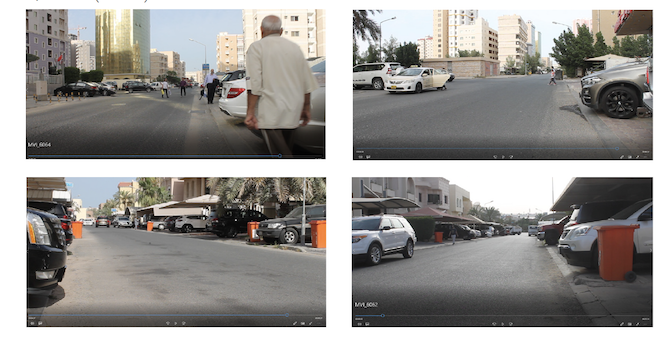
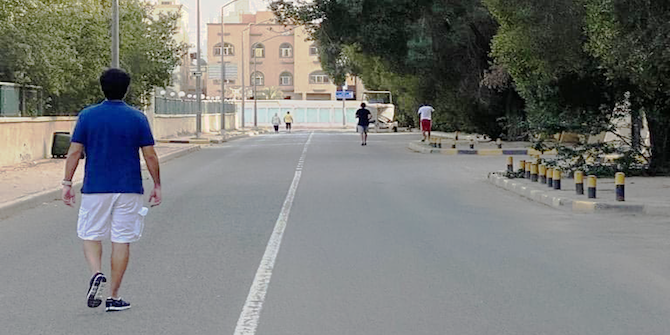
Figure 1: Video screenshots of the case study streets in Salmiya (above) and Qortuba (below). Source: Alexandra Gomes
Demystifying the Effect of Local Climate on Public Space Use
Some of our findings are contrary to popular myths of public space use. We often hear that extreme temperatures in Kuwait are prohibitive and that climate restricts public space use. Despite the prevalence of this belief, temperatures in the country vary, and for eight months of the year they are moderate, ranging from 15 to 40C. Our observations demonstrated that, excluding extreme periods, weather did not seem to have a noticeable effect on the intensity of use and, instead, the social demographic and the type of activities are deciding factors in the use of public space. In fact, throughout the cooler and warmer seasons, we observed pedestrians using the streets for different activities, although car use dominated. In both periods, the largest demographic group of users were lower income non-Kuwaiti male workers, albeit with low levels of permanence, or ‘stickiness’. In both streets, we found that people do not interact; instead, they are passageways or destination points for daily errands (e.g. bank visits, dining, car cleaning, goods deliveries or construction activities), and mostly reached by car. In Salmiya, due to its mixed use character, everyday activities such as smoking, talking on the phone, playing, and gathering are dominant, mostly in Salmiya Park and in and around commercial establishments along the street.
Emphasising the Co-Dependency Between Urban Factors
Our analysis reveals that there are three significant factors to consider when exploring urban public space in Kuwait: the impact of Kuwaiti-non-Kuwaiti socio-demographics in the planning of residential communities, road network connectivity and user behaviour, and street-level or microscale accessibility and urban design.
While most non-Kuwaitis live in higher-density clusters, and those from a lower-income group depend on public transportation such as buses, most Kuwaitis live in large villas and rely on private vehicles for their commute. Lower density residential neighbourhoods that are zoned for single use dominate the Kuwaiti landscape. Unlike mixed use development that creates vibrant city life, these neighbourhoods incentivise private car use and hinder walkability and socialisation. We recommend a diversity of programmes and multi-functional land use planning along with better public space design that would break the unsustainable cycle of residential development. Increasing urban densities while updating infrastructure to accommodate this increase is also important. Lighting, shading elements, water fountains and more seating should be included in the planning of public space as they will increase street safety and ‘stickiness’. Penalties must be enforced on those who break building codes and planning regulations, including the annexing of pavements for car parking and private use. This habit breaks street connectivity. It also discourages people from walking and produces unsafe environments for those who have to step into the road to avoid physical barriers. Improving pedestrian infrastructure includes the addition of zebra crossings, pedestrian traffic lights, wayfinding and speed limit signs that are missing in both case studies and their surroundings. These simple design improvements organise traffic flow, tip the balance towards pedestrians rather than vehicles, and create safer streets. We call for more accessible, reliable and attractive public transport, accessible to all, as well as segregated bicycle infrastructure that would help discourage private car use and support the social use of public space. However, successful public space improvement cannot be achieved piecemeal. Efficient policies will have to consider the strong and interdependent relationship between urban planning, urban design and individual and cultural behaviour.
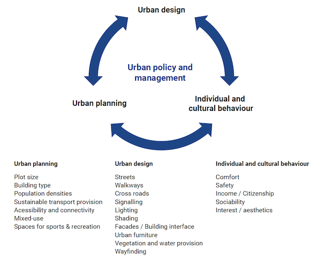
Figure 2: Diagram showing the interrelationship of Urban Design and Individual Behaviour.
Advocating for User-Centred Methods
On this basis, and as we reached the final stage of our research in a COVID-19 world, with parked cars and streets occupied by people, our user-centred investigation of public space becomes even more relevant. Our research offsets the dominant use of quantitative methods that can overlook the human component and instead relies on a more holistic approach, supported by qualitative methods of analysis. Observation, participant interviews, note-taking, site surveys and mapping, photography and videography were some of the tactics used for data collection. Additionally, we found that Gehl’s methods and the Pedestrian Environment Data Scan (PEDS) were helpful tools in understanding the challenges and opportunities facing Kuwait’s residential neighbourhoods. By using these accessible methods that can easily be replicated, we have created a baseline that can be used to compare to other streets in Kuwait or other neighbourhoods and cities around the world.
Sustainable policy and design changes can influence healthier individual behaviour. They can encourage sociability and environmentally friendly mobility patterns. We witnessed behavioural and environmental changes during lockdown, where public space use in neighbourhoods increased and limited car use and grounded planes improved Kuwait’s air quality. These potentials should be explored further. Kuwait is vulnerable to the impacts of climate change and can no longer support its current unsustainable method of urban planning that prioritises private car use at the expense of environmental, economic and health challenges. As we slowly emerge out of this COVID-19 crisis, Kuwait must rethink its car reliance, reassess its housing types and sizes, explore mixed use planning and build diverse and equitable socio-economic residential communities. The pandemic clearly illustrated that we must design more resilient urban environments. It also demonstrated the need for evidence-based research, design practice and policies. These findings, among others, are examined in greater detail in our report Reclaiming Public Space in Kuwait’s Residential Neighbourhoods.
This is the first in a series of posts about the Kuwaitscapes game and its uses, looking at how creative thinking and an understanding of the city can inspire game and design-based interventions to make Kuwait’s public space more welcoming to all. Please follow #Kuwaitscapes on social media for updates!
In this series:
- Public Space Use in Kuwait: From User Behaviour to Policy-Making by Alexandra Gomes, Asseel Al-Ragam & Sharifa Alshalfan
- Reimagining Public Space Through Cards in Kuwait by Alexandra Gomes, Sharifa Alshalfan, Asseel Al-Ragam & Tanushree Agarwali
- Hacking Kuwaitscapes by Alexandra Gomes, Sharifa Alshalfan, Asseel Al-Ragam & Tanushree Agarwal