Professor Catherine Boone and her Spatial Inequalities in African Political Economy research team introduce us to the collaborative project between scholars in the UK, US, and Kenya…
Kenya has a long and complex history with regard to land. Part of that history is the use of settlement schemes as a strategy for land distribution and agricultural development. Professor Catherine Boone of International Development and Government at the LSE has been working with Dr. Fibian Lukalo, Research Director of the National Land Commission (NLC) of Kenya, and the University of Richmond Spatial Analysis Lab to document these schemes and trace their histories as part of an ESRC-funded project led by Prof. Boone on “Spatial Inequalities in African Political Economy.”
This policy-relevant research requires multiple methods of investigation to answer questions such as: how have scheme size, siting, endowments (soil quality, rainfall), proximity to cities and infrastructure, social service provision varied over time? Does development activity vary across schemes in different parts of Kenya? Quantitative aspects of the study based on data supplied by the Kenya Ministry of Lands and maps from the Survey of Kenya are combined with and informed by ethnographic inquiry and interviews with key stakeholders. Qualitative research allows a deeper investigation into questions about changing livelihood strategies over time and across generations or perceptions of land access across schemes, socio-economic status and gender.
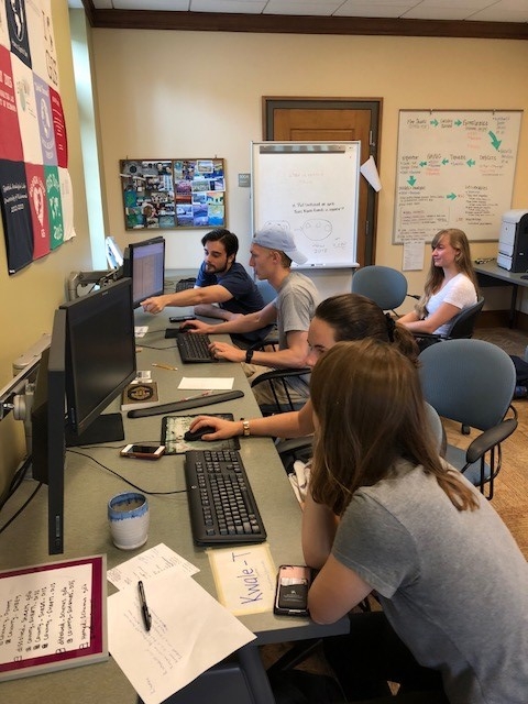
The project began with creating a geodatabase of the maps of Kenyan settlement schemes. The Kenyan National Land Commission (NLC) estimates that around 500 settlement schemes were created in Kenya from 1963 to 2017, with almost 300,000 families resettled over the course of this period. The large number of schemes points to an even larger number of map sheets at the Survey of Kenya — over 1,200! — all of which are being georeferenced by project team members. Some of the work on georeferencing and digitizing these map sheets is being done in Kenya at the NLC, led by Mr. Paddy Makene, and some in the US at the University of Richmond Spatial Analysis Laboratory under the supervision of Professor Kimberley Browne, and with university support led by Prof. Sandra Joireman of the Political Science Department, who is an expert in land tenure issues in East Africa. As the University of Richmond team has discovered gaps in the data, Dr. Lukalo and her staff at the NLC have filled them, combining their georeferencing work with meetings with officials at the Survey of Kenya and the county level to obtain missing map sheets and fill in gaps in the Ministry of Lands database. This can be challenging work. In order to find missing map sheets, NLC researcher Sheila Claron Pamba liaises between the centrally located Survey of Kenya and physical planning offices in the county governments outside of Nairobi. While this part of the project is about 50% complete, parallel and complimentary forms of data collection are occurring in Kenya.
‘Ground-truthing’ the data
From 16th August to 6th September, a team of four people from the NLC conducted fieldwork on the settlement schemes in Trans-Nzoia County. The objective was to build a county ethnography, conduct interviews, and fill the gaps in the database on Trans-Nzoia County. This qualitative data can help us answer policy-relevant questions such as how have livelihood strategies changed over time and across the generations? What do land acquisitions and losses through sales, etc., mean to individuals and families? How do perceptions vary across schemes, socio-economic status, gender, and the generations?
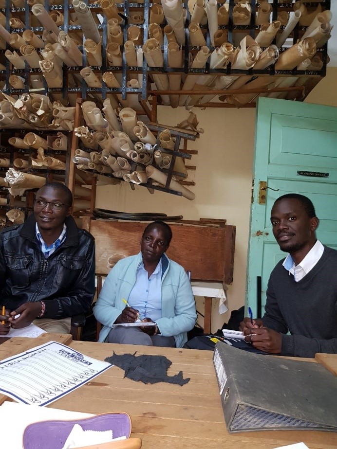
The Kenya-based team led by Dr. Lukalo held meetings with Local County Administration officials, chiefs, Ward Administrators, Heads of Departments and the County Government and Survey of Kenya to help understand some of the inconsistencies and trace the history of the settlement schemes in this county. For example, the team discovered a map collection covering the 1940s-1970s in the county-level archives of the Ministry of Agriculture (pictured above, including team members Maureen Jerono and Paddy Makene). They have also been able to identify schemes that are not yet registered, are subject to court disputes, and/or have not yet been degazetted from government forest lands. Team members collected and verified maps from the County Survey Office and conducted field interviews with stakeholders such as professional staff from the Ministry of Lands and Physical Planning, local elders, and settlers within specific schemes.
Next Steps
In October, a team from the NLC will travel to the University of Richmond to complete the database. The team hopes to use this data to compare settlement schemes 1962-1980 to those 1990-2012 (snapshot comparison); analyze the of evolution of early schemes over time (before and after comparison, or tracing trajectories); compare settlement scheme farms/localities to those in neighboring jurisdictions under different land tenure regimes (static or snapshop comparison); and compare of the evolution over time of smallholder scheme farms with evolution over time of farms in different land-tenure jurisdictions. In any such comparisons, we could seek to account for/control for variation in timing of scheme creation, scheme type, scheme location (for proximity, agronomic conditions), and the institutional structure of the scheme. It will be possible to draw on earlier research by Boone (2014) and Joireman (2011) for hypotheses about differences in institutional effects over time. The project aims to be complete by 2021.
The Spatial Inequalities in African Political Economy is a collaborative effort between scholars in the UK, US, and Kenya:
Professor Catherine Boone (PI) – Department of International Development
Dr Leigh Gardner (Co-PI) – Economic History
Dr Michael Wahman – Political Science at Michigan State University
Dr Andrew Linke – Geography at University of Utah
Dr Fibian Lukalo – The National Land Commission of Kenya, and research assistants in Government and Economic History at the LSE and University of Nairobi in Kenya
The views expressed in this post are those of the author and in no way reflect those of the International Development LSE blog or the London School of Economics and Political Science.